Saturday and Sunday both look like surf days.
We will have a mix of peaking S swell, background SW energy, and local NW windswell, on Saturday that will fade slowly on Sunday.
Most spots will hold around waist-chest high while the standout S facing areas will pull in some inconsistent shoulder high+ sets...(particularly on Saturday but becoming less frequent as we move into Sunday).
Winds should be ok as well...NW around 5-15 knots for most of the pacific side. Cabo and the East Cape will have variable S-W winds around 3-8 knots throughout the day...cleanest around midmorning.
Friday, May 30, 2008
Travel Swell Alert: Another large SW swell heading to Central America and Mainland Mexico
We have got another strong storm brewing down near New Zealand that is looking to send a hefty SW swell to Central America and Mainland Mexico later this month.
California and Baja Mexico will also see some waves from this one but they will be quite a bit smaller.
Short-range forecasts are expecting this storm to be a beast...NOAA's WavewatchIII is predicting nearly 40-50' seas in the core of this system. Here check out this image from the swell model.

You can check out the animated version of this here
http://polar.ncep.noaa.gov/waves/latest_run/nww3_pa.anim.gif
Here is a shot of the swell (in swell period form) about 6+ days from this post.

As you can see it sent a pretty solid blast of energy towards Tahiti and then on to Central America and Mainland Mexico. You can also see the South Pacific Island shadowing that occurs on SW swells (it is always sad to see that gap in the swell line up perfectly with SoCal...damn islands).
Here is the animation run for the swell period...you can watch the swell move across the pacific.
http://polar.ncep.noaa.gov/waves/latest_run/nww3_pa.anim.2.gif
If you look close you can actually see that the bigger swell isn't the only one in the water...there are actually a couple of other SW swells that have been kicked out. This is great from a travel perspective...it means that you aren't putting all your eggs in one basket...so you will have a good chance to score a longer run of waves.
Ok enough about the storm here are the arrival times and details on the swell.
Central America and Mainland Mexico - Since the swell is pretty SW in swell direction (210-225) it is actually going to both regions about the same time. There is another smaller SW swell coming in from the same direction that arrives on June 6th and holds around for a couple of days. This first one looks good for head high and overhead surf at the standout breaks maybe even a few bigger sets at top spots. The bigger swell hits on June 9-10th with surf in the overhead to well-overhead range for most areas while the standouts, mostly in Southern Mainland Mexico and Northern Central America see double-overhead+ sets. Spots light Puerto Escondido will probably go bigger than that as well. There will be some shadowing for Costa Rica and Panama from the Galapagos islands...so expect smaller surf in those countries. One other thing to keep in mind is the weather...TS Alma just got done douching the area with rain...it may not be very easy to travel to the more remote spots.
Baja Sur - The first SW'er (205-220) hits Baja Sur around 7th and sets up some shoulder-head high surf for the standout breaks on the Pacific Side...the Tip/East Cape may be a bit shadowed so expect smaller less consistent surf through that area. The second, bigger, SW swell peaks on the 10-11th with more shoulder-head high+ surf for the average spots and inconsistent overhead+ sets at the standout breaks. If you head down this way try and keep in mind that while there will be decent waves in this area it will lack a lot of consistency...especially compared to a swell coming in from a more southerly swell direction. So plan on it being fun...but not all-time.
Southern California and Baja Norte - Socal will have the first SW'er (200-220) limp in around the 7-8th...not the greatest swell for SoCal but it will put some chest-shoulder high sets at the top breaks in South OC and San Diego. The second, larger SW'er hits on the 11th with average spots building into the chest high+ range while the standouts, again in San Diego and South Orange County, see shoulder-head high sets. (I am being a bit conservative...there may be a bigger set sneaking though at times).
Nor/Central California – It actually hits about the same time as SoCal so you would be seeing the first swell on the 7-8th and the peak of the larger swell around the 11th. This one should be good for some head high sets at the standout SW facing spots…and you won’t suffer as much inconsistency as SoCal.
Anyway that is what I got for now...we still have enough lead time to get a cheaper plane ticket (if you get on it in the next day or so.) As usual if you head out of town make sure to send me some pictures and let me know how it was.
Thursday, May 29, 2008
Tropical Alert – Tropical Storm Alma
Hey gang we got our first Tropical Depression last night, which has now turned into a Tropical storm, and may become a hurricane later today.
Before you get too excited look at where it is located…

It is pressed right up against Central America and it is forecast to move back over land before it dissipates, (which means no surf for us.)
Here is how the odds of getting swell of break out right now.
Chance of getting surf in SoCal – 0%
Chance of getting surf in Baja Sur – 0%
Chance of getting surf in NorCal - 0% (I wish I could put less than zero)
Chance of Central America getting slammed by heavy rain, lightening, and flash floods – pretty damn good
Anyway even though it isn’t a swell-maker I thought I would pass it along. It shows that there is potential in the EPAC for more storm formation. Cross your fingers that we get one to spin up in our swell-window before too long.
I probably won’t be issuing a ton of posts on each storm (just as they increase surf potential)…so if you need more information or just more consistent updated make sure to check out the National Hurricane Center website.
http://www.nhc.noaa.gov/index.shtml
Wednesday, May 28, 2008
Thursday's Surf in Baja Sur - New S swell and a bit more wind.
Thursday will be a surf day...but it may get a bit breezy in the afternoon.
New S swell starts to move into Baja Sur on Thursday and mix with our current (but inconsistent) SW swell, local windswell, and some remnant S-SW energy still lurking around in the background.
In general it will start off a bit slow in the morning. Most breaks will continue to run in the waist-chest high range while the standout combo spots and really good S-SW facing breaks see some inconsistent bigger sets.
Look for that new S swell to fill in more as we move through the afternoon...eventually getting the exposed areas (Particularly around the Tip) into more consistent chest-shoulder high sets along with a few bigger waves sneaking through at times.
Winds look like they start off mostly clean with light and variable morning conditions along both the Tip and the Pacific Side. By the afternoon Pacific Side spots will have NW winds around 10-15+ knots...the tip will have some W bump around the same speed. East Cape areas will get a bit of the weird eddy off the tip and will have some variable S bump (but under 10 knots) by the afternoon.
Get to the S facing spots if you can...don't expect a ton of waves in the morning but it will be worth it to be in position as the swell starts to peak during the afternoon and into Friday.
Another Fatal Shark Attack in Ixtapa Mexico
I know I am a couple of days behind but I just caught this story on the interweb and thought I would pass it along in case some of you missed it.
According to news sources there have actually been 2 new shark attacks, one of them fatal, down around Ixtapa-Zihuatanejo coastline in Mainland Mexico.
If you remember Adrian Ruiz a surfer from San Francisco bleed to death from a shark attack while surfing the nearby area of Troncones Beach in April.
These latest attacks were reported at a beach called Pantla and at Playa Linda beach.
At Pantla Beach, Osvaldo Mata, was reported to have been mauled by a large 6' shark which bit off his hand and gouged his thigh. Apparently his brave friends paddled over and helped him to shore but he died of his wounds before medics arrived.
You can read more about the fatal attack here
http://www.reuters.com/article/newsOne/idUSN2430753720080524
The second attack, which occurred a couple of days later at Playa Linda, was on Texan Bruce Grimes. According to the news article the shark gave him a quick swim-by and then snagged his arm as he was trying to get back to the beach. After a bit of a struggle Grimes apparently was able get away from the shark and make his way to shore and eventually drive to medical help where he ending up with something close to 100 stitches. (Got to give the man credit for keeping his shit together enough to get to help.)
You can read more about the attack at Playa Linda Here http://www.reuters.com/article/latestCrisis/idUSN26346680
Man this is crazy...it really seems like 2008 has been a horrible year for shark attacks both domestically and internationally. (If some of you have seen a story about year to year frequency of shark attacks forward it on).
I love animals and nature as much as the next guy (if not more) but I am definitely starting to have issues with humans getting pushed back into the food chain.
Tuesday, May 27, 2008
Wednesday’s Waves in Baja Sur – more summer fun
Looks like a surf day in Baja Sur…I guess I will claim it surf-hump day. (Sounds good)
Anyway we have a blend of S swells and some local NW windswell setting up the surf for the day. It looks good for a waist-chest high+ surf for the average exposed breaks while the standout S facing areas, particularly along the tip and the east cape, see some shoulder-head high waves on the better sets.
It will be a bit inconsistent at times but should see a decent run of waves as the tide push moves through.
Personally I would stick with the top spots…they are the top breaks for a reason…they will help to focus the swell a bit better and will be more consistent than the out of the way breaks.
On another note there is a new tropical disturbance developing near Central America…they are expecting it to slowly develop over the next few days. Who knows we might get lucky and get an early season Tropical Storm to break loose as we get closer to the weekend.
Monday, May 26, 2008
Tuesday’s Surf in Baja Sur – a few playful ones
Tuesday looks like a surf day…not huge…but playful.
We will have a mix of inconsistent SW swell along with S swell and local NW windswell. Most spots will have surf in the waist-chest high range while the top combo spots and good S facing breaks along the tip will see some inconsistent shoulder high sets.
Winds look ok as well. NW flow around 10-15 knots will push through most of the day…showing strongest through the afternoon.
I would plan on trying to surf a well exposed break on Tuesday…something that really brings in a lot of swell…not one of the more sheltered point breaks. I also wouldn’t plan on wasting a lot of time or gas finding waves. Check the good/close spots…but don’t empty the tank hunting down surf that isn’t there.
Sorry there was a little lag on the Baja forecast...just got swamped out by the holiday weekend.
Friday, May 23, 2008
2008 East Pacific Hurricane Season – Update
The Climate Prediction Center just issued a seasonal outlook for the 2008 East Pacific Hurricane Season.
As usual the actual “outlook” straight from the government is a bit on the dry side…but basically is breaks down to this.
The official opinion is that it will be a below average season. The CPC is estimating that there is a 60-70% chance of the following.
11-16 named storms (tropical storm level or higher)
5-8 hurricanes (Cat 1 or higher)
1-3 major hurricanes (Cat 3 or higher)
Which while it is cool that they give specifics for the number of storms I am not really sure that it means that much when you factor in the 30-40% margin of error.
It is worth remembering that from a surf standpoint it isn’t so much the quantity of the storms but the quality. We have had plenty of good tropical surf seasons with only a handful of hurricanes…it is just that a lot depends on where the storms form and how they behave. With a few well placed storms and we can get a ton of waves. (Though the odds are better the more storms we get…yeah I love having to contradict myself in the same paragraph)
Here is a little post I put together a couple of weeks ago that has some info on what to look for…
2008 East Pacific Hurricane Season
You can read the official NOAA press release here http://www.noaanews.noaa.gov/stories2008/20080522_pacifichurricaneoutlook.html
Here is the actual seasonal outlook from the CPChttp://www.cpc.ncep.noaa.gov/products/Epac_hurr/Epac_hurricane.html
Tuesday, May 20, 2008
Wednesday in Baja Sur – fading but fun
The S swell will be slowly dropping on Wednesday but most exposed areas will continue to have some good waves. Plenty of surf showing at S facing spots.
Look for the average exposed areas to have surf in the chest-shoulder high range on the sets while the standout breaks see some inconsistent shoulder-head high waves on the best sets.
Waves will become less and less consistent as we move throughout the week so try and get as much as you can before it fades out. Point and reefs will continue to be the best call but as the swell drops some more look for the beach breaks to start to open up a touch more.
Monday, May 19, 2008
Tuesday’s Surf in Baja Sur – Have your arms fallen off yet?
Have they? Well I hope they do you lucky bastard.
The S swell was peaking throughout Baja Sur today…with many spots seeing well overhead surf at times. Points and Reefs were probably pretty sick…please send some pictures if you have some.
Tuesday will be just as good. The S swell continues to roll solid and conditions look OK as well. Look for the best surf to show at S facing points and reefs…with the points probably being the best call since you can pick a smaller section on the inside if the overhead surf is a bit much for you. In general most S facing spots are running solid overhead to several feet overhead on the sets…this will continue for most of the day.
My advice to you is surf as much as you can...you lucky dog.
Friday, May 16, 2008
2008 Hurricane Season
May 15th is the official start of the East Pacific Hurricane season…or what I sometimes like to call “special happy time” but more frequently refer to it as “a royal pain in the ass for surf forecasters”. In celebration of the start of the season I thought that I would throw together a little info on East Pacific Hurricanes and how they affect the surf in Southern California.

Unless you have been living under a rock in the Himalayas (that doesn’t have cable or satellite TV) you probably have at least an idea of what a hurricane is…so I won’t spend a ton of time going over the storm itself…here is the official version from the National Hurricane Center…
“The terms "hurricane" and "typhoon" are regionally specific names for a strong "tropical cyclone". A tropical cyclone is the generic term for a non-frontal synoptic scale low-pressure system over tropical or sub-tropical waters with organized convection (i.e. thunderstorm activity) and definite cyclonic surface wind circulation
Tropical cyclones with maximum sustained surface winds of less than 34 knots are called "tropical depressions" Once the tropical cyclone reaches winds of at least 34 knots they are typically called a "tropical storm" and assigned a name. From there when winds reach 64-knots then they called “hurricanes” (or cyclones or typhoons…depending on what geographic region you are in).”
The official version is a little dry considering they are trying to describe potentially one of the most destructive releases of latent heat energy that can occur in our atmosphere…but hey that is government for you…I am sure that they could describe a nuclear explosion in a way that would make you fall asleep after the third paragraph.
For this little lesson…first I am going to throw down a little geography and terminology, because that is the way that I roll, and it will help our conversation about surf make more sense later, particularly when we start dealing with active storms. Anyway here is a little of the geography…
Our region is a little “special”
When you look around the world there are generally 7 areas that have consistent cyclone activity but our special little corner in the east North Pacific actually boasts an extra-bonus feature…our storms have a tendency to move away from land and generally pose less of a danger to life/limb/and property. Don’t get me wrong…they are still ass-kicking weather systems and will sometimes spin back and wreak havoc through Mexico and Central America...but they are quite a bit less likely to do so than the other tropical regions.
This is sort of a catch-22 from a surf standpoint…hurricanes have a tendency to send the strongest swell along their movement path, which means that while we don’t have storms make landfall, (and come along and stick it in sideways like they do to the East Coast sometimes), we also don’t always get the best swell that we could from these systems.

The Layout
From a geographic standpoint the East Pacific tropical region runs from the west Coast of Central America, down to the equator, and then out to the 140W longitude line. The northern border is a little more flexible since storms have a tendency to die off as they hit cold water.

The incubator
The Gulf of Tehuantepec and the surrounding areas have a tendency to be the storm incubator of the EPAC tropics. The mix of coastal geography, local wind patterns, and extremely warm water provide a good catalyst for storm formation. In most tropical seasons you can track a number of storms back to this little caldron that is located down along the coast of southern Mainland Mexico.

The ITCZ
The ITCZ is short for “Intertropical Convergence Zone”, which is good that they gave it an acronym because writing the full term gets old fast. The ITCZ is an area where two different cells of air circulation meet along the surface of the ocean and push skyward. This convergence has a tendency to create a band of thunderstorms and tropical systems that are the early stages of tropical waves (and eventually full tropical cyclones). Anyway the ITCZ is more of a fluid entity than a fixed weather feature…oh it always exists…but it can move around and change intensity as different factors influence it. The ITCZ is important in the fact that it provides a low-wind zone for tropical storms to start their cyclonic rotation without being disrupted. From a forecast standpoint it is important to keep track of the ITCZ…the further north it drifts the better of a chance you have a storm formation…to close to the equator and you lose the Coriolis Effect.

Sea Surface Temps
When it comes to forecasting surf from hurricanes it is always important to keep an eye on sea-surface temperatures. Hurricanes need some very specific conditions to form and maintain circulation. One of the biggest factors is the ocean temps. The general rule of thumb is that a storm needs sea-surface temps to be at least 80-degrees Fahrenheit (or around 27-degrees Celsius)...and that temperature needs to extend down about 50-meters below the ocean surface. The storm doesn't actually draw that much energy from the water but it is more about the water temperature's effect on the air-mass directly above it. (this sort of gives me a headache...so I leave the heavy mental lifting to the NHC's big brains)
Due to limitations of public satellites it is hard to get a read on ocean temps beyond what you can see on surface but you can sort of guestimate where the pockets of storm potential water is.
Once a storm has moved out of the warmer waters it starts to lose power as its convection fails. This also means a lot of the storms winds start to lift up off the surface of the ocean and swell production is cut off, which is obviously a good thing to keep an eye on if you are trying to score surf from a hurricane.
Upper level steerage and sheering winds
On some levels hurricanes are actually pretty fragile weather systems...we already talked about their need for warm water/airmass which affects them from a surface standpoint...well they also need specific conditions to occur in the upper level of the atmosphere in order to start circulation. In particular they need some light/moderate winds blowing through the higher altitudes to sort of spark up the circulation that eventually becomes the full-scale cyclone convection. If these winds are too light then the storm won't spin up. The adverse is true as well...if the winds are too strong they will shear the top of the storm off, breaking the balance needed to maintain rotation.
One thing to watch is how the large scale wind patterns are moving through the tropical region...sometimes a storm will start in a favorable area only to move into a region that has more wind moving in the upper levels and it will begin to shear...and again once the storm starts to unbalance the surface winds get disrupted and swell production is shut down.
La Nina and El Nino (its Spanish for "the nino"!)
You hear a lot about El Nino/La Nina patterns in connection to hurricanes...and they do have a strong influence on the season as a whole...but it is good to think of it in terms of "potential" rather than a guaranteed stellar surf season. Both of these patterns represent the difference in SST's for the East Pacific region. An El Nino year means that the SST's are above average and the La Nina means that they are below average. The thing to keep in mind that there is quite a difference between an El Nino that is 0.5 degrees warmer than average compared to an El Nino that is a whopping 4+ degrees warmer. The amount of energy that it takes to heat a large area of the ocean is staggering and the more heat that is poured into it the more energy it will have to release later to equalize itself.
Here is the official definition from the Climate Prediction Center...
El Niño - El Niño, a phase of ENSO, is a periodic warming of surface ocean waters in the eastern tropical Pacific along with a shift in convection in the western Pacific further east than the climatological average. These conditions affect weather patterns around the world. El Niño episodes occur roughly every four-to-five years and can last up to 12-to-18 months. The preliminary CPC definition of El Niño is a phenomenon in the equatorial Pacific Ocean characterized by a positive sea surface temperature departure from normal (for the 1971-2000 base period), averaged over three months, greater than or equal in magnitude to 0.5oC in a region defined by 120oW-170oW and 5oN-5oS (commonly referred to as Niño 3.4). El Niño, which would appear off the coast of Peru around Christmas time, is Spanish for "the boy" referring to the Christ child.
Basically when you break it down...an El Nino year means warmer water in the East Pacific Tropical region...more warm water means more potential hurricanes. La Nina means cooler water and less potential hurricanes…(Funny thing about that is the opposite is actually true for the US East Coast. El Nino means a less active tropical season while a La Nina means a more intense one. Damn can’t they make anything easy.)
And finally...this picture sums up the El Nino perfectly...

Ok enough science...lets get on to the surf.
Does your head hurt...yeah mine too...lets talk about the fun stuff...the surf that a hurricane can kick out.

Hurricane surf is pretty special...it has a tendency to be punchy, stacked up, and at the right spots...really hollow. It also can sneak in from swell angles that we could never get from normal southern hemi storms, which in turn lets it hit spots that are normally small and sheltered.
If you have been surfing for a few years you probably have a hurricane surf story...everyone does...they sort of go "remember hurricane 'blank'? Man I surfed this longboard-spot/reef/harbor-entrance/evil-lair-point-break...it was like double overhead and reeling!"
The thing is that hurricane swells feel magical...they usually hit over the summer when the water is warm and clear and the swell is so consistent that you surf until your arms want to fall off. When you start thinking about Hurricane swells in the terms of the waves that you will surf of course you want to score more and more of it.
Getting Hurricane Surf
When you get down to brass tacks hurricanes are similar, but smaller, versions of mid and upper latitude storms...so the same principles apply to them when it comes time for them to generate swell.
You may want to brush up on how waves are made...you can read my barely coherent ramblings on that here.
Here are the basic things that you need to keep in mind when forecasting surf from hurricanes.
Storm Size - The bigger the storm the larger the fetch, the more fetch the more potential swell.
Intensity - The greater the wind speeds the bigger the surf...generally goes hand in hand with storm size since the bigger storms have a tendency to have more intense wind speeds than the smaller systems.
Movement track - You want a storm to be moving toward you. Hurricanes that are moving are sort of like flashlights...the swell is sent out the along the movement track. So the longer the storm is moving toward your location the more swell (and bigger waves) you can expect.
Movement Speed - This is tied to movement track...a storm can move too fast and sort of outrun the swell it is producing, which limits both the quality and quantity. A slower moving storm will have time to build a better sea-state, which lets it build a better swell. A perfectly paced storm will actually create a "travelling fetch" which will let the storm pour more energy into waves that it has already created...basically building the swell without the need for faster winds.
Storm Track vs Storm Speed
Ideally if you want to get great hurricane surf you want the storm to be moving toward you at a slow to moderate pace. Now actually getting a hurricane to head your direction isn't all that probable...it is sort of like herding cats, (well if the cat was 300 miles across, didn’t respond to the slightest human stimuli, and could smash everything that you care about into tiny pieces…then yeah it would be just like that…where was I? oh storm movement) this is where good storm speed can help compensate for a bad storm track.
If we go back to the flashlight analogy...the faster a storm moves the tighter the beam of swell becomes. If a storm is stalled or moving at a very slow rate it is sending out energy in all directions but as the storm speed picks up the swell energy tightens along the movement path. This image is a good illustration of what I mean.

You can still get swell from a hurricane even if it isn't headed directly towards your location but the system needs to be moving at the correct speed in regard to your position.
These are good rules of thumb concerning storm speed.
1. The Storm is moving away from your location: You want the speed to below 2-knots
2. Storm is moving along a path 90-degrees perpendicular to your location: You want the speed to below 5-7 knots (depends on the storm size...a wider storm can be moving a touch faster).
3. Storm generally toward your location: You want the movement speed to be below 8-10 knots.
4. Storm is coming to punch your ticket and drive up your homeowners insurance: Then you can have storm speed up to 15-17 knots and still get swell...any faster and the system starts to outrun the swell energy…and probably your ability to escape to safety. (Man aren’t I cheery today)
Seasonal expectations
While you can get hurricane swell at almost any time during the tropical season... Southern California definitely sees better hurricane swell activity as we move through the middle to end of the season. The reason for this is more due to the nature of the seasonal wind patterns than anything.
During the "Early Season", which runs from the spring into early summer, tropical systems have a tendency to track straight from east-to-west and move out into the open ocean.

As you get into the middle of the season, which is summer into early fall, the storms start to make a slight jog northward and eventually hook back toward land. This hook starts to line up the movement track with SoCal making it more likely for us to get waves.

Finally at the end of the season most storms are performing the “hook” sometimes right after they have formed. This is one of the more dangerous times to be along the Pacific side of Baja since storms can spin back toward land relatively quickly. They can cause a lot of damage even making landfall as a tropical wave or depression…remember there is a lot of dry land in baja that can’t hold a lot of water…so even a couple of inches of rain (or say the 30 inches a tropical storm can drop in a short period) can cause major flooding.

Naturally you want to be somewhere in the middle/end of the season where the storms have a chance of "aiming" towards SoCal and the Pacific side of Baja.
Swell Windows and Swell Directions
Swell windows are pretty darn important to Hurricane swells...more so than the bigger frontal systems. First off a hurricane is a smaller storm so the fetch is narrower and the swell is more focused...this compounded by the fact that hurricane swells generally have shorter swell-periods which don't wrap around corners as well as long-period swells. So if the storm is out of your swell window you are sort of out of luck...I have seen swells where the angle of the swell will cut off surf like a knife-blade as you move a 1/4 mile up a beach.
Generally Orange County and LA have the most SE’erly swell windows and can take in swells from 155-160 degrees…some of the other spots like north San Diego, Santa Barbara, and Ventura start seeing swell around 170. Other very protected areas like the South Bay need a more traditional SW swell around 200 degrees (which isn’t all that common for a tropical systems.
My half-assed opinion on the 2008 tropical season.
Ok this post is way to freaking long...so if you made it all the way down to this part then you are probably at work, in class, or prison...somewhere where you have a lot of time on your hands.
Anyway I will try and sum up quickly...looking the long-range climate data from the CPC and the NHC it looks we may have a slower than average season. The CPC (Climate Prediction Center) is calling for weak La Nina condition for the EPAC for May, June, and July, which means less warm water available for storm production. Dr Grey over at the University of Colorado is calling for a stronger season in the Atlantic which usually indicates a slower season in the Pacific as well. They do expect the La Nina to weaken later in the summer, potentially increasing tropical storm activity as we head into late summer and early fall.
Personally, and my opinion of long-range climate models isn't really work all that much...I would basically expect a slow start to the tropical storm season, less major hurricanes and fewer named storms for the next few months. As we reach late summer this should turn around and become more active...setting up better swell potential as we head into the second half of the tropical season.
That is all I got for now...make sure to keep checking the blog I will probably talk about each tropical system as it forms throughout the season...either that or I will drink more this summer...I would say the odds are about 50/50 right now.
My favorite Hurricane Links
Here are a few of my favorite links to hurricane related stuff...I will drop these on my link list as well.
Climate Prediction Center
http://www.cpc.ncep.noaa.gov/
National Hurricane Center
http://www.nhc.noaa.gov/
NHC Satellites
http://www.nhc.noaa.gov/satellite.shtml
Navy Research Laboratory Monterey
http://www.nrlmry.navy.mil/tc_pages/tc_home.html
University of Hawaii - Tropical Page
http://www.solar.ifa.hawaii.edu/Tropical/
FNMOC Ensemble Forecasts (good place to see upper level winds)
https://www.fnmoc.navy.mil/efs/efs.html
NOAA Sea-Surface Temps
http://www.osdpd.noaa.gov/PSB/EPS/SST/contour.html
Weekend Surf in Baja Sur – more swell on the way!
Baja Sur will have a surf weekend.
Saturday will be a bit slow as we try and pull in mostly leftover energy but new S swell starts to fill in on Sunday and should have some decent surf showing at the standouts by the end of the day (the new S-SE swell peaks Monday and Tuesday).
Saturday will see mostly waist-chest high surf off the S swell and the local windswell. A few of the best combo breaks and great S facing standouts may have some inconsistent shoulder high sets on the tide push.
Sunday will have slowly building S-SE swell that fills in slowly through the day. Look for waist-shoulder high surf at the top spots through the morning and near head high+ surf arriving by the afternoon/evening. (looks like Monday should have sets going a couple of feet overhead by midday).
Winds and weather are looking good but Saturday may be a bit breezy with W winds around 10-15 knots for most areas...though it does look cleaner for the more northerly Baja Sur spots on the Pacific Side.
Sunday is much cleaner with light and variable winds through most of the region and only moderate onshore flow through the afternoon.
Really you should try and get into position for the bigger S-SE swell on Saturday….there should be enough energy coming from the lead elements of the storm that you will have some playful waves…but with the main push of swell arriving Monday and Tuesday you are going to want to be camped out at a good S facing reef/point. I personally would sacrifice some surf on Saturday to score Sunday/Monday/Tuesday.
Good Luck and send me pictures!
Thursday, May 15, 2008
Friday in Baja Sur - waiting for swell
Friday will be surfable...not big but still fun at the top spots.
Look for mostly S swell and a touch of local windswell on Friday. Most spots will be in the knee-waist high+ range while the standouts see some chest high+ sets. Waves will be a bit inconsistent and soft overall but you should have fun on the lower tides.
Again it won't be worth driving too far to surf on Friday...but if you want to start to get into position for the new S-SE swell that hits late in the weekend and early next week Friday would be a good day to get on the road.
Wednesday, May 14, 2008
Thursday in Baja Sur - S swell, a few waves, and waiting for the bigger swell this weekend
Thursday will be a surf day in Baja...nothing great but not flat either...just, well, sort of surfable.
We will have a mix of lingering S swell and local NW windswell. Most spots will continue to see waves in the knee-chest high range while a few of the best breaks, mostly the combo breaks, see some chest high+ sets.
Winds start off light with mostly W-NW flow but under 5 knots. Look for onshore winds out of the WNW around 10-15+ knots by the afternoon.
Again I don't think it will be worth hunting around for surf on Thursday so just stick with the local spots...maybe you will get lucky on the lower tides. Really I would just spend the next couple of days playing around and then move to a good S facing spot for the new S-SE swell arriving late in the weekend. (Yeah for S swell!)
Swell Alert - New S-SE swell for Southern California and Baja
There has been an evil-looking nugget of a storm spinning down in the SPAC over the last few days.
QuikSCAT was recording nearly 50-60 knots of wind in an area of fetch aimed mostly towards Baja and, to a lesser degree, Southern California
Here check out this chart

This is a close up of the storms core...see the black wind barbs...the ones with the little triangles indicate 50 knots of wind...the ones with the triangle and extra lines means +50 knots (10 knots for each full line).

And here is the lovely, yet super small, WWIII visual product viewer...along with my usual incredibly artistic arrows. (man I need to get adobe illustrator on my computer at work...photoshop is killing me).

Anyway this storm has been holding in place for a few days which is pretty good for swell production. It actually started off a little less intense...so it pushed out some weaker S swell before it set up a bigger lump of energy.
From a surf standpoint Baja Sur, in particular the Tip/East Cape areas, will see the biggest part of this swell.
SoCal will see a smaller, but still fun, version of the same swell at the good S facing breaks once the swell moves up into our area.
Here are the more specific details...
Baja Sur
Baja will see this new S-SE swell (170-185) arrive on Sunday the 18th and fill in slowly through the day. Eventually the swell peaks on Monday and Tuesday (May 19-20) with surf in the shoulder-overhead+ range for most exposed breaks and top standout areas see sets going 2-3' overhead at times. It should be a fairly consistent swell in the Baja Sur/Tip area thanks to the open swell window...but expect size to drop off a touch as you move up the Pacific side.
Southern California
SoCal will see this new S-SE swell (170-180) arrive on Monday May 19 and build slowly at exposed breaks throughout the day. It will actually be overlapping a smaller pulse of S swell already in the water so it should be pretty fun even though the bigger swell won't really get going through the afternoon. The S-SE'er will actually peak Tuesday and Wednesday (May 20-21). Look for the average exposed breaks to see chest-shoulder high+ surf. Standout spots, mostly through Orange County and a few other select areas, see head high and overhead sets. Weather (at least at this point) is looking good for this swell...cross your fingers that the wind forecasts hold together.
Tuesday, May 13, 2008
Wednesday’s leftovers in Baja Sur – still fun but it is stretching a little thin
More leftover S swell will limp in on Wednesday and mix with a touch of local WNW windswell and background energy.
Most spots will be around waist high while the standout combo breaks see some inconsistent chest high+ sets. Expect a lot of the power of the swell to have faded out leaving the surf on the gutless side.
Don’t spend a lot of time driving around looking for waves…not much will be showing anywhere. You might stick to spots that have something else to do besides surf (IE fish, golf, drink, go to the strip-clubs, ect, ect)
WNW Swell Alert: North Pacific gets off another shot of WNW swell before the summer!
We have a decent sized WNW swell (290-300+) heading into Northern and Central California later this week. Looks like weather will be good too. I would start working on your "sick" excuses for ditching work.
The North Pacific storm track just won't quit this year...every time it looks like it is about to kick the seasonal bucket it spins off another storm. This latest system formed to the northeast of the Hawaiian Islands and is setting up fetch for Northern and Central California as it moves into the Gulf of Alaska.
While it is weak compared to "normal winter" reckoning it is still is very healthy considering that it is May. You can see on the QuikSCAT image below that it is showing winds in the 35-45 knot range right in the key areas of fetch.

Here are the details on this swell...
Northern California
Look for the WNW swell from this storm to arrive throughout the day on Friday and then peak overnight into Saturday. Wave heights will be consistently in the head high to overhead+ range while the standout NW facing spots see well-overhead sets.
As a huge bonus winds and weather are going to cut us a break as well...the springtime gale that we have had for what seems like forever is finally going to back off right as this swell hits. Friday and Saturday will have clean morning conditions and only moderate onshore flow below 15 knots in the afternoons.
Southern California
This swell isn't aimed very well for SoCal...we will see some energy but the brunt of the WNW energy (290-300) will be blocked by Point Conception.
Look for this new WNW-NW to arrive through the day on Saturday, peak late in the afternoon and hold into Sunday. Like I said above SoCal will be much smaller...mostly knee-chest high at the exposed breaks, but we may see a touch of S-SW swell in the water as well which would allow a few peaky sets to sneak through at the combo breaks.
Make sure to keep an eye on the offshore 49059 NOAA buoy...we should start to see some new energy showing around midday/evening on Thursday.
Monday, May 12, 2008
Tuesday's Surf in Baja Sur
Tuesday will still be a surf day but look for our surf to be fading fast through the day.
S swell drops quick by the afternoon and there isn't much on tap to replace it as it fades out. Look for most exposed spots to see surf in the waist-chest high range while the standout S facing breaks, and good combo spots, see some shoulder high sets.
Winds will be on the light side with flow out of the NW around 10-15 knots for most of the day.
Your best bet is to stay in position and milk the last bit of this S swell before breaking camp. Try and surf early since the most size will be showing then...the afternoon will be smaller and windier.
Sunday, May 11, 2008
Happy Mother's Day!

I just wanted to say happy Mother's Day to all the surf Moms out there!
Have a great Day!
Hopefully your family buys you that new swallowtail fish you have been wanting! (or at least takes you on that trip to Costa Rica)
Friday, May 9, 2008
Fun Surf in Baja - S swell continues to peak through the weekend.
The S swell continues to peak on Saturday in Baja Sur (and eventually peaks on Sunday in Baja Norte).
Expect S facing beaches will have surf in the chest-shoulder high range with some head high sets at the better breaks. Standout S facing breaks in Baja Sur will have consistent overhead sets.
The waves will slowly fade by Sunday afternoon.
Basically if you are reading this you are just doing it to torture yourself...(I feel like I am torturing myself by writing it). I would love to be down in Baja Sur surfing a head-high to overhead S swell on some long lonely desert point.
Thursday, May 8, 2008
Friday’s Surf in Baja Sur – S swell fun!
New S swell starts filling in on Friday (eventually peaking on Saturday). Look for fun playful surf at most exposed breaks both on the Pacific side and on the Tip.
Most breaks will start off around chest high+ through the morning. Standout spots may be slightly bigger.
Look for more and more size to arrive as we head into the afternoon. Top spots will have some inconsistent head high sets mixing in before sundown.
My advice is pretty redundant…there are waves, you are in Baja, go surf. Personally I would hit up a nice long point break but that is just personal preference.
Jake Shimabukuro Plays at the Surfing Heritage Foundation
Hey guys, my friend Casey over at the Surfing Heritage Foundation passed on a press release for another cool event, and I thought I would pass it on to you.
This time it is a concert by ukulele virtuoso Jake Shimabukuro with the proceeds going to the "preservation of surf culture for the education and appreciation of current and future generations."
Like many of their events it sounds like a good time...and it is always sweet to go and check out all the historical boards and gear that they have on display.
Here are the details for the event (and the press release).

Jake Shimabukuro Plays at the Surfing Heritage Foundation
SAN CLEMENTE, Ca. -May, 2008. The Surfing Heritage Foundation will be hosting ukulele virtuoso Jake Shimabukuro on Sunday, May 25th. The concert will be held at the Foundation’s cultural heritage facility located at 110 Calle Iglesia, San Clemente, CA 92672. Show time is 7:30 pm and doors open to the general public at 6:30 pm. General admission is $25. VIP tickets, which include dinner, drinks and premiere seating, are available for $75. Proceeds from the concert go to the Surfing Heritage Foundation and their ongoing work of preserving surf culture for the education and appreciation of current and future generations.
Jake Shimabukuro (she-ma-BOO- koo-row) is fast becoming recognized as one of the world’s top ukulele musicians. His virtuosity on the four-stringed instrument defies label or category, playing jazz, blues, funk, classical, bluegrass, folk, flamenco, and rock, Jake’s mission is to show everyone that the instrument is capable of so much more than Hawaiian music. Jake has played and recorded with a treasure trove of other musicians including; Jimmy Buffet, Diana Krall, Fiona Apple, Bobby McFerrin, and Ziggy Marley. He has also appeared on The Late Show with Conan O'Brien.
Also on the bill for the evening is surf comedian Jaz Kaner, a silent auction featuring artwork and photography donated by Art Brewer, Ken Auster, Tyler Warren, Celine Chat and Jay Adler, and two special Kala Ukulele’s hand painted by artists, Wade Koniakowsky and Drew Brophy.
Surfing Heritage Foundation would like to recognize title sponsors, Heritage Global Solutions and Hoffman California Fabrics. Also supporting the event is: Crevier BMW & Mini, Rainbow Sandals, and Pacific Coast National Bank. In-kind support from; SC Times, Surfer Magazine, Karl Strauss Brewery, Barefoot Wines, Kala Ukuleles, Lost Energy Drinks, and Wahoo’s.
For more information on tickets, call (949) 388-0313 or email linda@surfingheritage.org.
You can also check out the Foundation on their website.
http://www.surfingheritage.org/
This time it is a concert by ukulele virtuoso Jake Shimabukuro with the proceeds going to the "preservation of surf culture for the education and appreciation of current and future generations."
Like many of their events it sounds like a good time...and it is always sweet to go and check out all the historical boards and gear that they have on display.
Here are the details for the event (and the press release).
Jake Shimabukuro Plays at the Surfing Heritage Foundation
SAN CLEMENTE, Ca. -May, 2008. The Surfing Heritage Foundation will be hosting ukulele virtuoso Jake Shimabukuro on Sunday, May 25th. The concert will be held at the Foundation’s cultural heritage facility located at 110 Calle Iglesia, San Clemente, CA 92672. Show time is 7:30 pm and doors open to the general public at 6:30 pm. General admission is $25. VIP tickets, which include dinner, drinks and premiere seating, are available for $75. Proceeds from the concert go to the Surfing Heritage Foundation and their ongoing work of preserving surf culture for the education and appreciation of current and future generations.
Jake Shimabukuro (she-ma-BOO- koo-row) is fast becoming recognized as one of the world’s top ukulele musicians. His virtuosity on the four-stringed instrument defies label or category, playing jazz, blues, funk, classical, bluegrass, folk, flamenco, and rock, Jake’s mission is to show everyone that the instrument is capable of so much more than Hawaiian music. Jake has played and recorded with a treasure trove of other musicians including; Jimmy Buffet, Diana Krall, Fiona Apple, Bobby McFerrin, and Ziggy Marley. He has also appeared on The Late Show with Conan O'Brien.
Also on the bill for the evening is surf comedian Jaz Kaner, a silent auction featuring artwork and photography donated by Art Brewer, Ken Auster, Tyler Warren, Celine Chat and Jay Adler, and two special Kala Ukulele’s hand painted by artists, Wade Koniakowsky and Drew Brophy.
Surfing Heritage Foundation would like to recognize title sponsors, Heritage Global Solutions and Hoffman California Fabrics. Also supporting the event is: Crevier BMW & Mini, Rainbow Sandals, and Pacific Coast National Bank. In-kind support from; SC Times, Surfer Magazine, Karl Strauss Brewery, Barefoot Wines, Kala Ukuleles, Lost Energy Drinks, and Wahoo’s.
For more information on tickets, call (949) 388-0313 or email linda@surfingheritage.org.
You can also check out the Foundation on their website.
http://www.surfingheritage.org/
Wednesday, May 7, 2008
Thursday in Baja Sur – one more day before we surf again
Thursday will be another waiting day. Or a good fishing day. Or a good travel day.
It won’t be that great of a surfing day.
There will be a mix of background SW swell and local NW windswell. Most spots continue to see knee-waist high surf. Standouts will be a touch bigger. All areas will be rideable, particularly with small-wave gear like longboards, but they will lack push and even the best spots will suffer under the tide swings.
Again I would probably use the day to get in position for the better S swell that begins arriving on Friday and eventually peaks on Saturday.
Tuesday, May 6, 2008
Wednesday in Baja Sur – Waiting for the S swell
Wednesday will have a few waves…but in general it will be mostly small and playful at the top breaks and just small at the average ones.
Look for a mix of S-SW swell along with the never-ending local NW windswell. Most breaks hold around knee-waist high while the standouts see some chest high waves on inconsistent sets.
Biggest waves will be out on the Pacific side, particularly at the spots that can pull in a bit of the windswell or really focus SW swells.
Winds hold out of the NW around 10-15+20 knots with the strongest gusts in the afternoon.
There is a light at the end of the tunnel…new S swell is due this weekend…it should be really fun at the S facing breaks in the next few days.
Monday, May 5, 2008
Tuesday’s Surf in Baja Sur – Time to regroup
Mostly leftovers will be showing on Tuesday in Baja Sur. It won’t be much of a surf day but there will be a few longboard waves sneaking through at the standout breaks.
On average look for surf in the knee-waist high range while the best combo breaks (that can pull in a little local windswell) will see some chest high sets.
Winds will be a bit breezy as well…NW flow around 20-25 knots will build in throughout the day and peak during the afternoon.
Really the next couple of days are good travel days. There is another decent sized S swell that will be moving into the well exposed breaks as we head into the weekend. Spend the next couple of days building your camping kit out and getting into position for this next swell.
S Swell Alert: UPDATE – Lots o south swell heading to Central America
Hey gang I was just checking up on that incoming S swell that will be arriving this upcoming weekend and things are still looking good.
Like I mentioned in the first post (click here to read the first one) the majority of this energy is heading towards Central America and Mainland Mexico…but Baja Mexico and Southern California are going to see some playful sized waves from this one as well.
Rather than retype all of the previous alert I through it in a picture this time. (The chart is actually the NOAA wavewatchIII peak-wave period forecast showing what will be happening late on May 10th. The giant red-orange blog eating Central America is the S swell. Click on the picture to get a bigger view.

In case you want to see what I wrote about this swell last week…
Previous Posts
S Swell Alert - New S swell brewing up around Antarctica
Sunday, May 4, 2008
Monday’s Surf in Baja Sur – I don’t think you can celebrate Cinco De Mayo when you are actually in Mexico
Monday will be a surf day…waves will be smaller but there should still be some fun ones at the top breaks.
Our SW swell will be fading fast on Monday. Look for the average breaks to back down into the waist-chest high range while the standout Pacific side spots see some chest-shoulder high+ sets on the best tides.
Winds are looking good as well…NW around 10 knots through the morning and onshore flow out of the WNW around 10-15+ knots for the exposed areas by the afternoon.
Friday, May 2, 2008
Weekend Surf in Baja Sur – Point break heaven
This is definitely going to be a surf weekend in Baja Sur.
Our new SW swell will continue to peak into early Saturday before slowly starting to fade out by the afternoon and into Sunday.
Most exposed breaks will have consistent surf in the chest-shoulder high+ range. Standout SW facing breaks and excellent combo spots will have overhead sets through Saturday morning. Look for those bigger waves to become less frequent by the afternoon and even more rare on Sunday.
Winds are expected to continue to blow out of the NW around 5-15 knots for most of the weekend. There may be some pockets of stronger NW flow along parts of the Pacific Side but those will occur mostly in the afternoons.
If you are surfing in Baja Sur this weekend…please go to a point or reef…I would be very disappointed if you went all the way down to Mexico to surf a beach break.
6.0 Lowers Pro Photos - Twisting the knife
So I went down to the 6.0 Lowers Pro this morning and it was firing…which was to be expected because I have daddy-daycare duties today and absolutely zero chance to surf.
But since 3 year olds can go to surf contests and sit on the beach I decided to torture myself by taking photos of Lowers this morning.
Really it is almost to painful to talk about…here just look at the pictures and you will see what I mean. I took all of these photos within about 35-40 minutes of arriving at Trestles.
(if you get this post as an email you may have trouble seeing the images…make sure to go to the blog itself to see all the gory details).

Lowers version of a skatepark

Look it breaks both ways!

Sick series...seriously the guy had 3 more turns that I could have put in this series that were just as good.

Set out the back

Well at least it is not a Toll Road...

They pimped my ride...man takes me right back to gradeschool

Some of the rights were connecting down to the whitewash at Middles

It was almost impossible not to throw spray

A frustrated pack at Uppers...lots of people burning each other while yelling swear words at the contest.

Even Middles had a couple of decent ones
As you can see it was a bit hard to watch...and fortunately for my sanity the wind started to pick up so I had an excuse to go home.
But if you have some time to kill this afternoon check out the full album...I shot about 200 photos so expect to take a while to get through them.
Click on the photo icon below to go to the gallery...
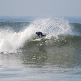 |
| 6.0 Lowers Pro Photos 5.2.08 |
Thursday, May 1, 2008
Official Forecast Update: 6.0 Lowers Pro and Oakley Pro Junior - Friday
Another forecast update for the 6.0 Lowers Pro...conditions look better and there should be more swell. I may actually run down to watch for a while. But if you are stuck somewhere else make sure to check out the live stream.
Here is the link http://www.nike6lowerspro.com/
Here is the actual forecast...effective for Friday May 2.
Friday the new SW swell will start to peak and conditions will continue to improve.
The surf will be a mix of new, peaking, SW swell (200-220), fading NW windswell, and some background S-SW energy that is helping to fill in a few of the gaps.
Wave heights will be in the chest-shoulder high range on the average sets and there will be some shoulder-head high+ sets sneaking through as the tide fills in.
Conditions will continue to clean up for Friday morning. Look for mostly light and variable to light offshore winds below 5 knots through the morning. Winds will shift light onshore around lunchtime, and then will pick up out of the W-WNW around 10-15 knots by the afternoon.
Expect similar wave heights and conditions to hold into Saturday.


Friday's Surf - uh just surf more
Friday will be another good surf day.
The SW swell will be peaking...and well...waves will continue to break at the exposed spots.
(I mean come on if you are reading this blog you are not likely out in the desert getting ready to have another great day surfing half-mile-long point breaks)
OK lets pretend that you have a plane and can be surfing at the spot of your choice tomorrow. If that was the case then you could expect surf to be in the chest-head high range for most SW facing spots. The Pacific Side spots will be a touch more consistent as a bit of WNW windswell moves into the more exposed areas...but the other more protected spots will be cleaner so that is sort of a wash.
Sets will be a bit inconsistent but fun when they show...points and reefs with a bit of protection from the wind will be the best call.
Anyway have fun Mr. Richie Richie with your super cool private airplane...if you need a personal surf forecaster to go with you please drop me an email.
S Swell Alert - New S swell brewing up around Antarctica
So I got some good news and some bad news.
The good news is that a well positioned storm has spun up just off the coast of Antarctica. The storm has some decent wind speeds, a wide area of fetch, and is moving in a good direction. This system will be kicking out a large S-SW swell for Central America and Southern Mainland Mexico while at the same time sending some healthy, but more playful sized, surf to Baja and Southern California.
The Bad news is that the swell will hit over Mother's Day weekend. So unless your mom rips chances are you won't get to travel to score some waves on this swell.
Here are a few charts that highlight this storm and incoming swell...


There are a couple of things to note about this storm...from a positioning standpoint the core of this storm is almost out of the SoCal window...not quite but right on the edge for many of the SoCal regions...fortunately the fetch is pretty wide so edges of the swell direction will be a little "fuzzy". If it had moved a touch further eastward the swell would have been going back against the grain of the storm track and would have had a really hard time making it to SoCal.
Also this swell won't have to squeeze through the South Pacific islands which is an extra-bonus for socal. With a cleaner shot at SoCal we will actually see a bit more size and consistency from this one than we would from a more SW'erly angled swell.
So onto the swell details...
Central America and Southern Mainland Mexico
The main push of the swell is definitely aimed towards Central America...and due to the position of the storm it will last for several days after it peaks.
At this point expect the new SW swell (it has more of a 200-degree swell direction in this region) to hit late on May 8th, build fast through the morning of the 9th, and then peak in the afternoon of May 9th into the 10-11th. Look for surf running well overhead through the 9th with sets starting to hit double-overhead+ at the standout spots by the afternoon. Those waves will hold through the weekend before slowly trailing off through the first part of the next week.
(Please note that Southern Mainland Mexico is about 1/2-3/4 of a day behind on arrival times so the peak of the swell still hits on the 10-11th but shows less energy on the 9th).
Baja Sur
The S swell arrives in baja Sur late on the 9th, builds through the day on the 10th and peaks more in the afternoon of the 10th into the 11th. It will be a bit smaller through this region...so look for plenty of shoulder-head high sets at exposed breaks and overhead+ sets at the standouts along the Tip. Expect slightly smaller surf the further north you move along the Pacific side.
Southern California
SoCal will have a smaller, but still fun version of this S swell (180). This swell will arrive later on the 10th and will fill in more overnight eventually peaking exactly on Mother's Day (May 11th) and holding into the 12th. At this point we can expect chest-shoulder high surf for most of the exposed areas in SoCal. Orange County, in particular North Orange County, will have some head high+ sets at the top breaks.
This one is still a long ways off so you should have time to get your Mom the gift she really needs...A family vacation to Costa Rica! (yeah...good luck with that).
Make sure to check back I will have more updates on this swell as it gets closer. As always if you get some good pictures of this swell send them my way.
Subscribe to:
Posts (Atom)